So you want to find out information on your historic house or neighborhood, but you are not sure where to start?
Fear not, for the City of Portland and Multnomah County offer several online databases to help you start your search. For this how to guide, we will use an example from one of Restore Oregon’s latest projects, Walnut Park.
County Surveyor – SAIL
To discover which platted addition to the city you live in, look to information at the county level. SAIL, Survey and Assessor Image Locator, provides access to survey information and tax maps for Multnomah County.
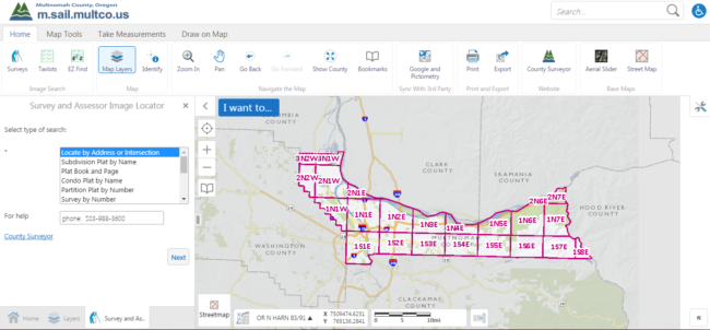
From this page, you can search by your address, subdivision’s name, condo name, or plat book. If you do not know your subdivision name or subdivision plat name, you can also zoom in on the map in order to find your address. While zoomed in, the subdivisions will begin to appear on the map. From here, you can determine which subdivision your address falls under.
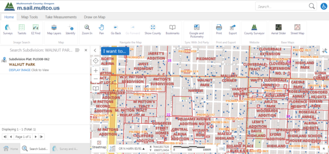
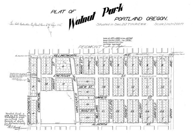
Back to “type of search,” you can now type your subdivision into the search bar. In our case, we know that our subdivision in question is named Walnut Park. Once this information is entered, SAIL will link you on the left tab to a PDF version of your subdivision’s original plat. The plat will provide information on who owned the land at the time of division, when the plat was submitted to the county, and when the county approved it. For Walnut Park, we now know the area was originally platted in 1904 by four couples: the Killingsworths, the Warrens, the Streibigs, and the Hills.
If you just want more information on your specific house or condominium, you can search by your address only. The map will zoom in on your search and provide several links. First, you can view the Tax Assessor’s map for your particular house and the surrounding buildings. You can also use a Guest Login to check Multnomah County’s Property Tax website.
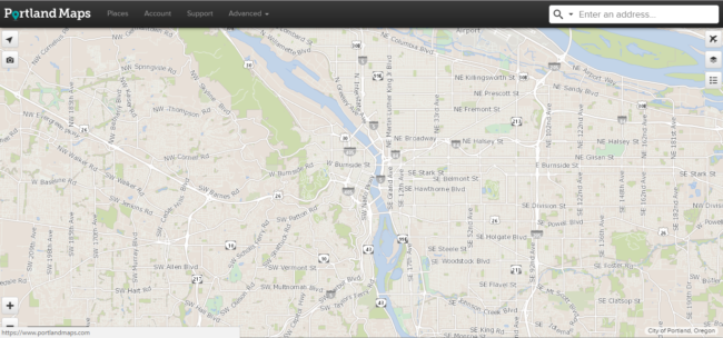
Portland Maps
The City of Portland hosts an interactive map that allows users to type in an address or zoom in on a specific house or building. The map links users to various permits, property information, and zoning overlays.
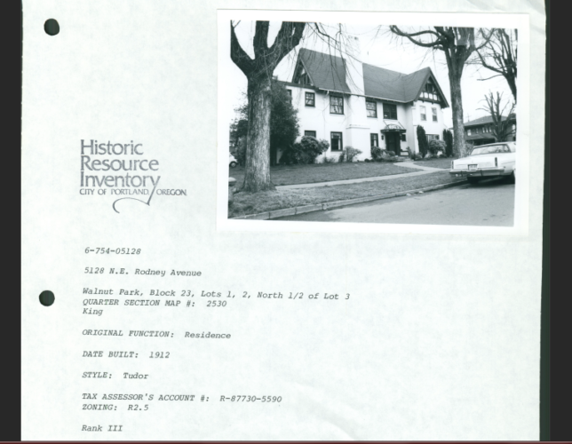
As you can see from this example, we now know that the Ocobock House, an important community landmark in Walnut Park, was built in 1912, zoned as single family residential, and is 5,486 square feet. If we scroll down, we can also look at assessor information, permits and zoning, and utilities.
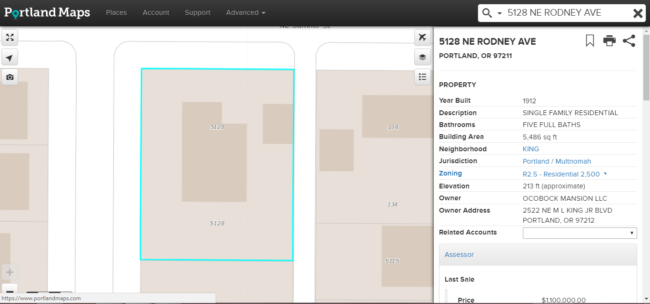
Portland Maps will link you to the various departments, for which they provide basic information on. For example, you can click on your building’s zoning on Portland Maps and it will link you to an explanation of what that zoning code means on the Bureau of Planning and Sustainability’s website.
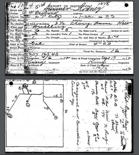
Under the permits tab, you can click on historic plumbing. Under “type”, a “plumbing permit” should appear. Clicking on this will link you to the plumbing permit for your house or building. Depending on the age and type of building, you may be able to see the original permit which will provide the last name of the owner at the time the permit was applied for. With the Ocobock House, we see that A.W. Ocobock filed for the original plumbing permit for the house in 1912, with the final inspection on September 12, 1912. Last names are usually a great start to conducting a history on your house or building…all from a plumbing permit!
Oregon Historic Sites Database
If you want to know if your house or building has any designation as a historic site, the Oregon Historic Sites Database is a great starting point.
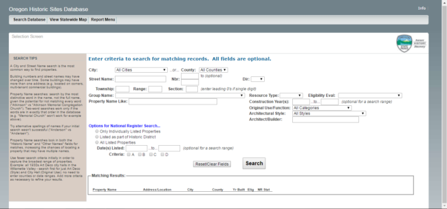
Your house or building may appear in the database for several reasons. The building may have been surveyed as part of the 1984 Historic Resources Inventory, it may be listed in the National Register, or it may be part of a historic district.
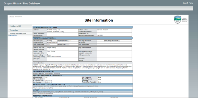
Again, we have the Ocobock House. As we can see, it is listed in the database. On the left hand side of the webpage, there are links to an inventory form. Clicking on the inventory form will link to PDF copies of the HRI documents that provide a brief history on the architecture and construction.
If we wanted to expand our search to the other buildings surrounding the Ocobock House, we could switch to the map view of the database. Using the “Select” tool, we expanded our research to include the project boundaries for Restore Oregon’s Walnut Park survey project.
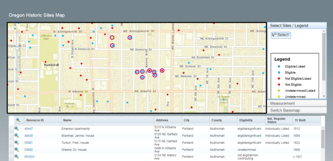
As we can see, the Ocobock House is close to other buildings that are eligible for the National Register or already listed. Altogether, there are ten properties already documented in our project boundaries. From these ten properties, we can learn more about the history and context of the Walnut Park area.
Historical Oregonian
Multnomah County Public Library offers many online research databases and tools that are free to use in the library or at home using your library card number. One resource that has proved particularly helpful for finding out information about past home owners, neighborhood events, etc., is the Historical Oregonian through Newsbank.com.

This resource allows you to search through issues of The Oregonian from 1861-1987. You can search by keyword, article title, author name, date range, or any combination of the above. Continuing with the Ocobock House, we now know A.W. Ocobock built the house in 1912. Therefore, we can use his name as a keyword and 1912 as a starting date.
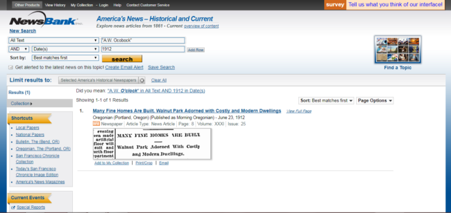
While these specific search parameters only generate one result, we now know that the Ocobock House was considered one of the “many fine homes” in Walnut Park. We could also expand our search parameters by including the former address of the house, a date range of 1910-1915, the years immediately before and after the house’s construction, etc.
This process could easily be applied to your own house and surrounding neighborhood! These resources are available online and easy to use. What can you find out about your Portland house or neighborhood?
