
Since 1866, the Cape Arago Light Station has provided a beacon guiding mariners along the Pacific Ocean near Coos Bay on the southern Oregon coast. The current 1935 lighthouse, which is actually 2.5 miles north of Cape Arago on Chief’s Island at Gregory Point, was placed on the National Register of Historic Places in 1993 for architectural distinction and significance in maritime history.
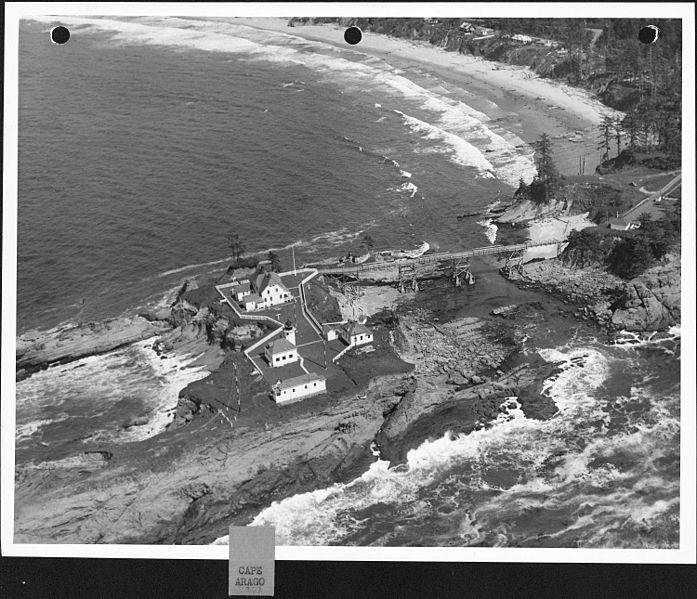
on Chief’s Island in 1944.
(photo courtesy of Rick Minor)
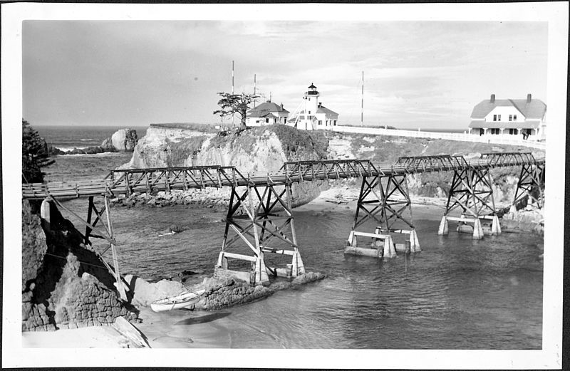
lighthouse on Chief’s Island in 1944.
(photo courtesy of Rick Minor)
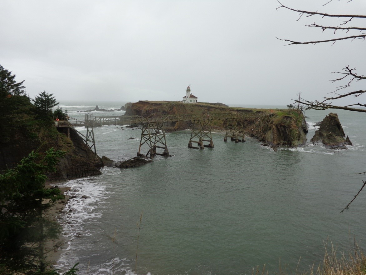
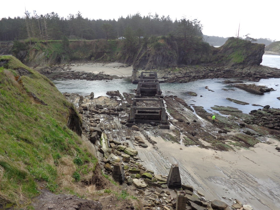
Chief’s Island before removal of the footbridge.
(photo courtesy of Rick Minor)
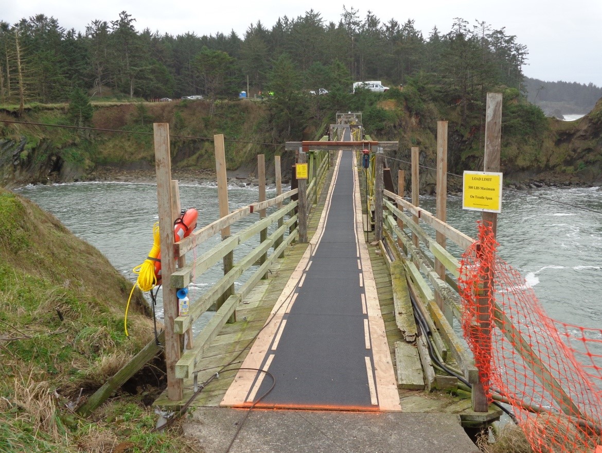
toward mainland before removal of the footbridge.
(photo courtesy of Rick Minor)
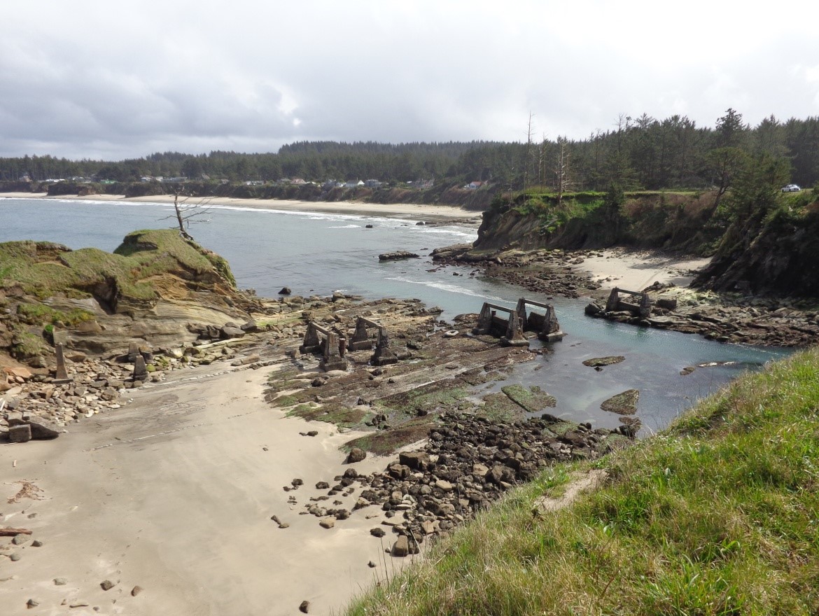
toward mainland after removal of the footbridge.
(photo courtesy of Rick Minor)
toward mainland after removal of the footbridge.
(photo courtesy of Rick Minor)
The site of the Cape Arago Light Station stands out for another important reason. The historic light station was built on top of a prehistoric Coos Indian village and this site on Chief’s Island represents a prime example of the fate awaiting many cultural resources—both historic and prehistoric—that are increasingly disappearing as a result of erosion by rising sea levels associated with climate change.
Prehistory
Long before the historic light station was constructed, Gregory Point was the setting of a Coos Indian village known as Baldiyaka. Evidence of this
village is still visible today in the form of shell middens, dense accumulations of the remains of shellfish, fish and other resources which were available at low tide along the rocky edge of Gregory Point. Limited excavations by archaeologists have established that formation of these middens took place over the last 2,100 years.
History
Severe erosion of the long sandstone headland has been a problem throughout the history of the light station at Gregory Point. The first lighthouse was built on the western tip of Chief’s Island in 1866. As erosion assaulted the island and put the first lighthouse at risk, a second lighthouse was constructed in a less exposed position on the eastern margin of the island in 1908. When this second lighthouse was threatened, a third lighthouse was constructed in 1935 at the center of the eastern portion of the island. It is this lighthouse that still stands today. Each of the lighthouses was at the center of a complex of buildings that included keeper’s quarters, crew quarters, out houses, oil houses, and storage sheds.
For most of the nearly 150 years of the light station’s existence, Chief’s Island was connected to the mainland by a series of bridges spanning a narrow channel cut by wave action into the headland. A low water bridge erected in 1875 was destroyed in 1877, replaced by 1883, and destroyed again in 1886. A high water bridge was erected in 1898, but was replaced by a similar trestle type footbridge at the same location in 1938. This bridge, measuring 389 feet in length and 8 feet wide, was identified as a contributing structure in the National Register nomination for the light station. A Historic American Engineering Record (HAER) study for the Cape Arago Light Station Footbridge was completed in 1993.
Removal of Bridge to Chief’s Island
Built in 1938, just three years after the existing lighthouse, the footbridge had not received necessary maintenance for most of the recent past. In conjunction with stabilization and repainting of the lighthouse, the decision to remove the hazardous bridge was undertaken as part of the transfer of Chief’s Island and the lighthouse from the U.S. Coast Guard to the Bureau of Indian Affairs, which will hold the property in trust for the Confederated Tribes of Coos, Lower Umpqua, & Siuslaw Indians. In 2013, the footbridge was cut into 54-foot-long sections and removed.
A Dim Future
Periodic surveys by archaeologists have documented the steady erosion of prehistoric Native American sites along the Oregon coast. Well over 100 recorded archaeological sites, most of which are on Oregon State Parks land, are threatened. Some sites observed by archaeologists in the 1930s and 1950s have already completely disappeared.
At Chief’s Island, only thin remnants of the prehistoric shell middens at Baldiyaka remain. The same severe erosion has already destroyed archaeological deposits and features associated with as many as two dozen historic buildings at the 150-year-old light station. Removal of the bridge cut access to Chief’s Island and has seemingly sealed the fate of the remaining cultural resources.
The ultimate fate of Chief’s Island can be envisioned at nearby Squaw Island (Qochyax Island), less than one-half mile away, where in the last few years the formerly forested island has become totally denuded of vegetation and soil down to bedrock. While the rate of climate change, and its underlying causes, may be a subject of debate in some circles, there is no question of its devastating effects on prehistoric and historic resources on the Oregon coast.
Editor’s note: An alternate perspective on deforestation was submitted to Restore Oregon subsequent to this article’s publication. The comment stated that “The loss of trees on the island was-and-is due to the nesting Cormorants. These birds will destroy small pockets of trees where they nest by removing the needles, and their fecal matter destroys the soil. Once the trees is void of a percent of needles, it will die…and when the soil becomes over-saturated with acidic matter, the trees will die.”
